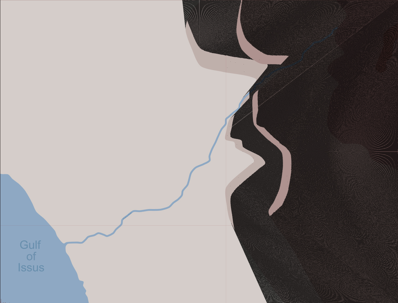
A new map – in this case Issus which is used for some of the LOS examples below. Note that the maps are no indication as to which battles will be covered in the first game! 🙂 (Click for the full-sized image)
Work has now started in earnest on the Line-Of-Sight subsystem. This is a crucial subsystem that will underpin a lot of the fog-of-war that a player will experience.
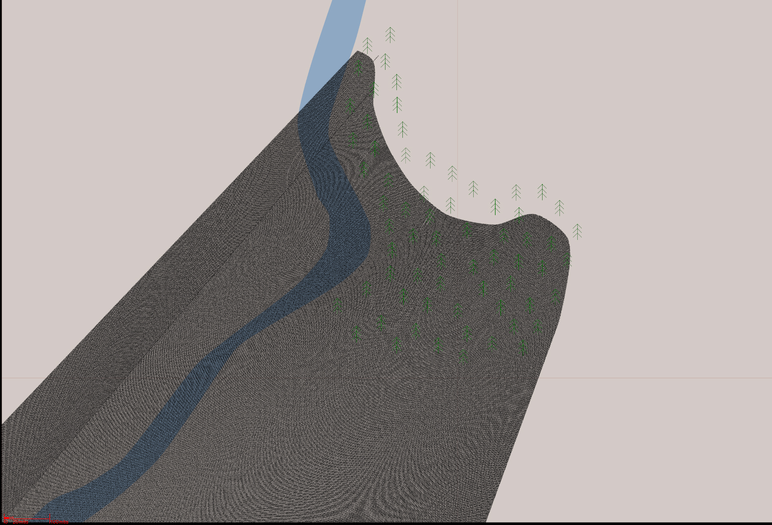
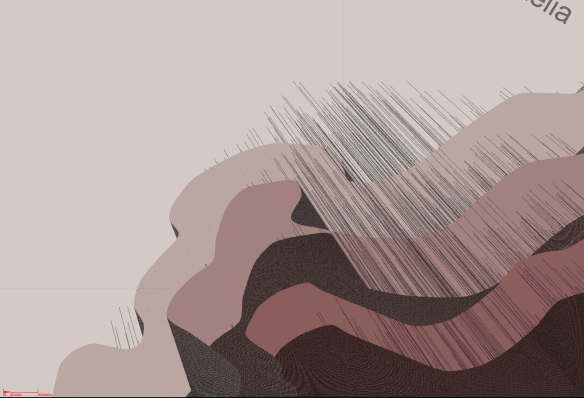
All of these screenshots show the maps subjected to a 360 LOS check from a man sized entity in the middle of the map. The dark areas are areas that the entity cannot see.
The initial results are very encouraging for only a few hours work. There are still some issues to iron out, but I have allocated a lot of time to get LOS right as it will form a critical part of the command and control system.
Anyways, I’ll leave you with the screenies!

The Issus map after the LOS routines have been run on it. (Click for the full-sized image)

A close up of the LOS calculations for the Issus map. (Click for the full-sized image)

The full Granicus map after the LOS routines have been run on it. As can be seen, there appears to be a few issues with the processing of this map… (Click for the full-sized image)

A close up of the woods at Granicus. Here the woods density had been set so that units would be seen up to 100 mtrs in. This can be altered on a per-woods basis. (Click for the full-sized image)
Whoops! Nearly there, but not quite right! Looks like I have some debugging to do! (Click for the full-sized image)
Have a Merry Christmas and a Happy New Year!
Laters
RobP